Wimbledon Soldier's First World War Trench Map Is Revealed
Maps were used in Flanders to break the German lines
A First World War trench map belonging to a Wimbledon soldier has been made available online for the first time.
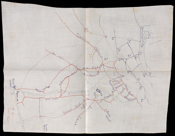
The map (see below) shows the routes of approach taken through the trench system during a British attack at Givenchy, in Flanders.
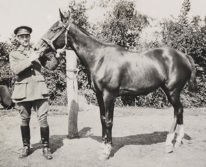
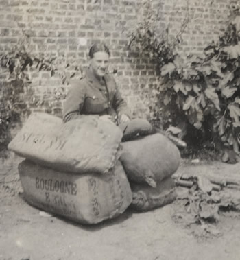
Printed on waterproof paper, the map, which belonged to Lieutenant Arthur Fancourt Logan (pictured right), was drawn specifically for the attack on 16 June 1915. This map, and others belonging to him, gives precise information about the attack, detailing front lines, communication trenches, and even enemy artillery and machine-gun positions.
These never-seen-before maps are being published on the Museum's commemorative online portal, First World War in Focus as part of the National Army Museum’s Soldiers’ Stories series.
British forces were focusing on a series of smaller attacks in Flanders to break the German line while the German army concentrated on fighting Russian forces in the East. Lieutenant Logan took part in one such attack at Givenchy in 1915 as a member of 2nd Battalion The Bedfordshire Regiment, which suffered heavy losses.The British would commonly bombard German trenches with mortar and artillery before commencing an infantry charge. However, on two consecutive advances this 'barrage' had proven ineffective, leaving infantry exposed to well defended German trenches, lined with barbed wire and manned by machine-gunners.
Fifty men in Logan's Battalion died that day, including five officers, with a further 72 men wounded. The 21st Brigade of which Logan’s Battalion was a part, saw over 1,000 men killed during the operation.
Arthur Fancourt Logan was born in Wimbledon in 1894 to parents Alexander and Christine. The eldest of four children, Arthur had a younger brother and two sisters. The family later moved to Bristol, where Arthur was schooled. At the outbreak of war in 1914, Arthur was on the Unattached List of the Indian Army, but he was soon commissioned to join the ill-fated 2nd Battalion The Bedfordshire Regiment.
As a member of the Bedfordshires, Logan fought during the First Battle of Ypres where 58,155 British men died, and the Battle of Neuve Chapelle, that saw the death of a further 11,200 British and Indian soldiers. Despite being involved in these bloody battles and the failure at Givenchy, Logan was miraculously uninjured, and was later awarded the Military Cross for his services, retiring as a lieutenant colonel.
Although he died in 1973, Logan's maps, never before seen by the public, are of great value to those researching First World War battlefields. The British Army went to war with relatively small-scale maps of France and Belgium, but with the onset of static trench warfare, larger and more detailed maps were needed.

Details about enemy trenches and the surrounding landscape came from air observation and soldiers who had raided opposition lines or taken prisoners. The Topographical Sections of the Field Survey units of the Royal Engineers used this knowledge to draw up maps, which were then printed and distributed to hundreds of thousands of men.
Dr Peter Johnston, Collections Content Team Leader at the National Army Museum said: "The National Army Museum’s Soldiers Stories series allows us to better understand the First World War from the perspective of those who endured it. Logan’s maps would have been vital to planning enemy attacks and defending the Allied Front. They add to our knowledge of the day-to-day lives of soldiers and have the broader benefit of giving us insight into the strategies employed throughout the First World War."
Such personal accounts are being unveiled each month in the Soldiers’ Stories series. They piece together the development of the war from the point of view of those directly involved – one hundred years from the time that they describe. The National Army Museum hopes that in sharing these personal stories, the human scale and impact of ‘The Great War’ can be better felt and understood.
An interactive global map also features on the portal, which geotags all the major events of the war, as well as a timeline to help users piece together the development of the conflict and a host of learning tools. The website is a unique resource that will help commit the events of one hundred years ago to the country's national memory in one central place.
First World War in Focus is part of the National Army Museum’s Building for the Future project, which is supported by an £11.5m grant from the Heritage Lottery Fund. The project will see the radical transformation of the Museum’s Chelsea site as well as an extensive programme of community projects, together with Regimental Museum collaborations, travelling exhibitions, loans and expert support.
Support from the Heritage Lottery Fund has also enabled the Museum to go on the road during its closure period, with a series of nationwide events around the country to commemorate the First World War and the bicentenary of the Battle of Waterloo in June 2015.
June 25, 2015
Related links
|

